ECDIS
Route Manager

by Yury Komar

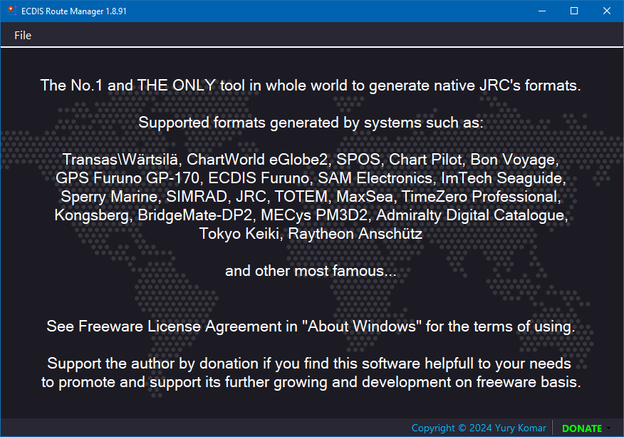
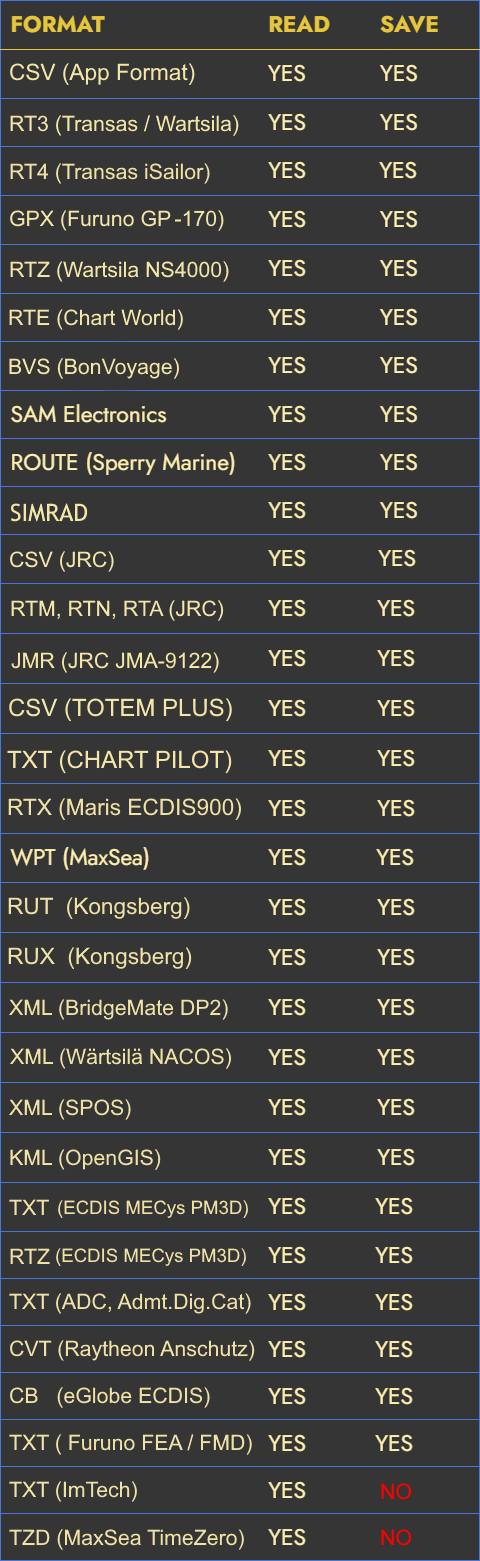
Manage routes of most famous formats such as:
RT3, RTZ, RTE, GPX, WPT, ROUTE, RTM, RTX, XML, KML, CVT, JMR
and many others.

Changes in 1.9.05.9486 (21.12.2025)

  • Fixed: Batch conversion was unable to start conversion.


Known issues, planned to fix in next release:

* JRC formats (RTA,RTN,RTM) calculated ETA is wrong, giving errors while loading to ECDIS.

Download World Map Installer

Short video review of ECDIS Route Manager 
on YouTube from our Indian colleague.


Software Description


  • ECDIS Route Manager is the No.1, and the only, tool in the WORLD to generate native JRC formats.
  • ECDIS Route Manager now support more than 30 route formats.
  • Software is able to read routes generated by systems such as:
    Transas(Wärtsilä) Navi-Sailor/Nacos/iSailor, ChartWorld eGlobe2, SPOS, Chart Pilot, Bon Voyage, GPS Furuno GP-170, ECDIS Furuno 3000, SAM Electronics, ImTech Seaguide, Sperry Marine, SIMRAD, JRC, TOTEM ECDIS, Chart Pilot, MaxSea, TimeZero Professional, Kongsberg K-Bridge, BridgeMate-DP2, Admiralty Digital Catalogue, ECDIS MECys, OpenGIS, Google Earth, Raytheon Anschutz ECDIS
    and other most famous formats.
  • Distance and Course Calculation may be switched to RL or GC.
  • For calculations using two projections: Mercator & Cartesian
  • By click on table header you may show or hide additional columns.
  • Has option to paint table rows in two colors (white and gray)
  • Can create new basic route with names and positions of waypoints.
  • Can save newly created or opened routes to many famous formats keeping dummy values to fulfill other fields.
  • Can open current table directly in Excel without intermediate saving.
  • Also may save as NATIVE CSV and make your own route using EXCEL, then load back in to the ECDIS Route Manager for further conversions.
  • With this software also could make a Batch Conversion of the different routes to a selected format. Helpful when you need to move all your routes from one format(equipment) to another one.
  • Application can show on Offline World Map the route file you are opening (to get such option, you need to download map cache)
  • Also, by default, online Map is supported, if your PC connected to the Internet to load the map on the way you scrolling it.
Formats table

. . . HISTORY . . .
I made this software to create, read and save electronic routes in various formats. Previously, the program was a simple Reader, but now it able to create a routes. I heard a lot of questions from people (navigators, navigational officers) who really need such software, and it was the impulse for its creation.

. . . PLANS . . .
The program will grow-up as needs arise and will be updated accordingly. You can follow the updates here on this website or use links above at the beginning of the page.

. . . COMMUNITY . . .
I would like to hear from all of you any ideas about what you would like to add, to remove and what to improve. Therefore, I will answer any questions with interest and hope for further productive co-operation. If you have a request to add a new format of routes, please specify from which equipment it is and attach the files, what I will use to work and test.

Discussion is highly appreciated.


Copyright © Yury Komar .
Made with ❤ in Vladivostok.
All Rights Reserved.